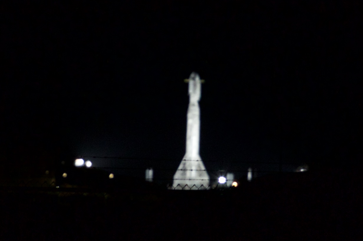
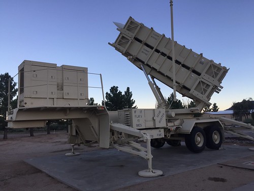
Falcon 9 at SLC-4 at night
Actually my first time watching any sort of rocket launch in person. A friend urged me to go watch one of the Space Shuttle launches before the program ended but I never did. (I did get to see the Shuttle Endeavor flyover at Facebook in 2015). I don’t know why I haven’t been down to Vandenberg sooner to watch a SpaceX launch. It’s not terribly far away and it would’ve been easy to take a day off if I needed to. I guess just watching the webcast was easier.
After the maiden flight of the Falcon Heavy I decided to finally go watch one of these things. I had my eye on the SpaceX-Paz launch originally scheduled for the 17th or 18th. I was going to drive down to Lompoc as well as do some exploring of the central California coast. I spent a while studying maps and trip reports from other people to figure out where to go. This page was written by a SpaceX employee was a good resource on making the trip. The night before I was supposed to leave I came down with a terrible cold, didn’t sleep, generally felt like shit and didn’t think I was going to go. Fortunately the launch was delayed until the 21st!
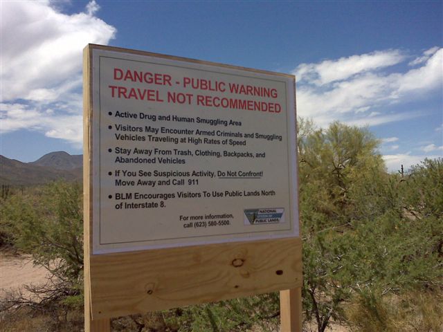
I drove down Tuesday afternoon. It was dark when I got there, but coming in from the north it was super obvious from the bright glow on the horizon where the launch pad was. I was positively giddy when I could see the Falcon 9 sitting on the pad in the distance. I drove out to Surf Beach to get an idea of where things were. The road is gated off beyond the beach, but from there it was a great view of the SLC-4 facility and the Falcon 9 on the pad.
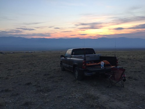
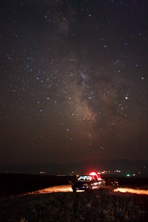
The launch was scheduled for 6:17 AM the next morning so I crashed at a Motel 6 for a few hours. The guide page recommended leaving an hour early to find a good spot, so I left a little before 5 AM. There were already several cars on the shoulder at Ocean Ave & 13th, and that’s where I parked. It was fucking cold, right at 32 F. My puffy ECWCS parka pants came in handy here. I had my HT tuned to 386.3 MHz and was able to pick up the Launch Net just fine. I had decent-ish cell reception so I kept tabs on the Reddit launch page and Twitter.
As it got closer to T-0, it was quickly getting brighter from the sun rising. I had my camera on a tripod, I figured I could get some sort of long exposure shot out of it but didn’t really know what to expect at all. Finally word came over the radio that due to high upper level winds the launch was scrubbed until tomorrow. Bummer.
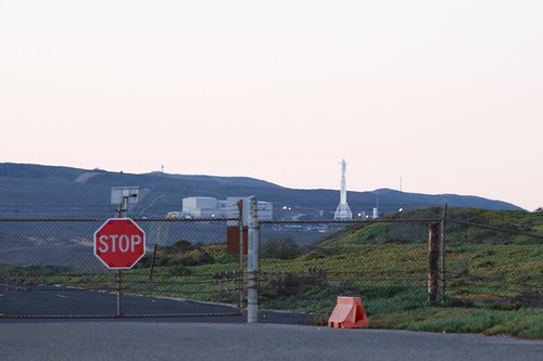
After the launch was scrubbed I headed back out to Surf Beach. Now there was an Air Force guard parked inside the gate. I took a few more pictures of the rocket, then wandered around on the beach for a while. It turns out when you get up at 5 AM you have a lot of time to do things, I had a whole day to waste. I went back to the motel and got another night, then headed down Highway 1 to Santa Barbra. I’ve never been been there so figured why not. I had fun exploring the coast and took a bunch of pictures. Driving down the entire Highway 1 along the coast is one of my to-do items, so I wound up driving all the way down to Santa Monica and back.
(Why are the freeways in southern California so much nicer and cleaner than ours? White concrete, palm trees, everything just seems clean. The freeways around the Bay Area are busted, patched, dirty, all the signs are dirty, all the medians and intersections are littered with trash and dead homeless people. Also they have many miles of pretty blue ocean, we have the gritty brown Bay that stinks in areas.)
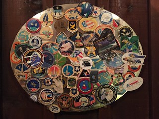
Mission stickers at The Hitching Post
Wednesday night I drove out to Casmalia to have dinner at the Hitching Post, something recommended on the Arring.net page. I had a great top sirloin steak, I can recommend this place. They have one section of dining room that has all sorts of signed aerospace posters and collections of mission patches and stickers hanging up, from all the crews working at the base.
Thursday morning I got up a little earlier and left at 4:45 AM. This time there were maybe a dozen cars already pulled off on the side of the road. It was still freezing outside, but still clear. Listening to the radio I could hear things getting closer, then finally the countdown! From where I was I couldn’t see the launch pad for the hill. Then it happened, there was a red glow over the horizon and the Falcon 9 peeked over the top. What I wasn’t expecting was how bright the engine flames were. It just silently and gradually went up in the air, then several seconds later there was a soft rumble that turned into a giant roar! I barely remember the sight of the rocket, but the image of the engine plumes are burned (heh heh) into my memory the most.
Ignition!
I also had no idea what to expect as far as how high it was going to go or if it would curve away. From where I was at, it went straight up really far and I had to tilt my head back to watch it. By now it was bright outside, so my long exposure photo idea didn’t work out. The few photos I did take were greatly overexposed and useless. The 24 mm lens wasn’t anywhere wide enough to capture the entire flight because it went up so high. I didn’t bother swapping out lenses to take anymore photos, I just wanted to watch it with my own eyes and take it in.
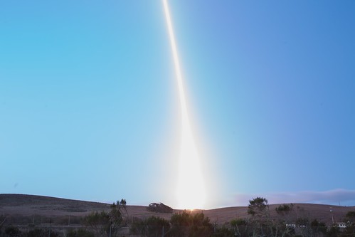
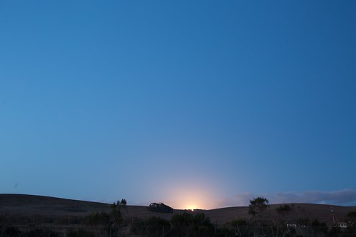
Long exposure of launch
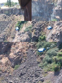
The rocket got smaller and smaller, and the engine plume got smaller and smaller as it went further away. I could see the main engine cut off, then see the second state light. It was this tiny puffy spec that eventually vanished. There were 4 things clearly visible after MECO, bright little pinpricks of light clumped close together like morning stars. I assume these were the booster, the two halves of the fairing, and the interstage. They were coming down very slowly, and eventually stopped being visible. The Launch Net over the radio was still reading out how the second stage was going. Soon there was nothing left to see, so I packed up. Amusingly there was a coating of frost on my camera tripod and chair when I picked them up.
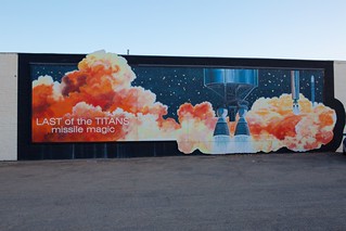
Titan mural in downown Lompoc
I went back to the motel and napped for a couple of hours. I headed home after that, following highway 1 and 101 back up. One interesting thing about Lompoc is that they have murals all over downtown, and many are space related. I had the idea that I would visit Hearst Castle on the way back, but I was pretty tired from lack of sleep and decided to pass it up.
Takeaways so I don’t forget:
- 386.3 MHz is useful to listen to. It appears to go online an hour before liftoff.
- Ocean Ave has the most unobstructed view, cars can really pack in there. The farm roads on the other side are also good spots.
- Get there at least an hour early for pick of the best spot
- A wide angle lens isn’t going to cut it here
- The rocket goes up super high
The next launch is March 28th, hoping to make that one.

