
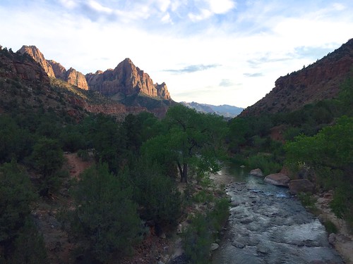
Virgin River in Zion
I recently quit my job because I got too burned out doing tech all the time and decided to take a year off to travel, camp, and explore. After my trip to eastern Utah a couple of months ago, I wanted to come back and check out Zion and Bryce Canyon national parks. I finally made that happen last week.
Instead of driving through Las Vegas, I took a northerly route through Reno and across Nevada on Highway 50. I got off to a super late start around 1 PM and hit slow bumper to bumper traffic outside Vallejo alllll the way to Sacramento. I don’t know if that was normal for a Thursday afternoon but it ate a considerable amount of time. The whole time I was pacing this brand new red Lamborghini who was also stuck in traffic with me, poor car.
I discovered that iOS location services on my phone was completely busted, which made using Waze or Google Maps incredibly frustrating. It would find my initial location but would fail to update as I traveled. No amount of resetting airplane mode, LTE, location services, nor apps mattered. I wound up falling back to my old Garmin Streetpilot which was loaded with maps from 2006. With the phone I could find out how to get somewhere from where I was previously; with the nav unit I could find out exactly where I was but maybe not necessarily how to get somewhere. Ugh. It soon didn’t matter anyways because as soon as I was off the interstate in Nevada I would lose cellular service frequently and needed the nav unit.
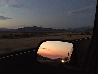 Fernley, NV was still there, looking like how I last saw it for Burning Man 2009. Driving along highway 50 in central Nevada I couldn’t help but notice how utterly lonely it was, there was nothing there but jackrabbits. There were a few naval air stations off the road and a couple of small run down towns and that was it. I later found out the road really is nicknamed “The Loneliest Road in America”.
 After a crazy diversion in the middle of the night (a whole ‘nother story), I got to Great Basin National Park around 3 AM. I hadn’t planned on going to the park, but given how late I left it seemed like a good spot on the map to stay overnight. At 4 AM I could already start to see faint sunrise on the horizon. I slept for a few hours in the parking lot and did a bit of sightseeing in the park after.
Of interesting note, this is where a 130+ year old Winchester rifle was found by park staff leaning up against a tree in the middle of the woods. I had heard the story about it but had no idea this is where they found it. It was on display in the visitor center along with some information on how they found and preserved it.
After leaving Great Basin I cut down highway 21 to intersect I-15 in Utah, not a whole lot to see along the way. Originally I had planned to go to Zion first but because it was already noon I didn’t figure I would be able to get a campsite. Besides, Bryce Canyon was closer so it made more sense to go there first.
July 7, Bryce Canyon National Park
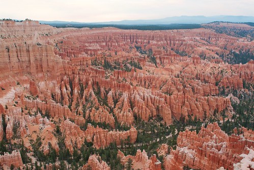
It turns out Bryce Canyon is a much larger tourist attraction than I thought, it looks like a deceptively small national park on the map. It was brimming with activity and the campsites were going fast, although I managed to call dibs on a spot in the northern campground. As soon as I pitched my tent a thunderstorm rolled in and it rained for 30-40 minutes. This was fortunate as it really cooled things down from 100+ F down to 80 F or so. It was getting late in the afternoon, I was dead tired so I didn’t do much exploring on Friday. There was also a full moon out so there was no star photography to be had.
Saturday I did more exploring of the park. The main amphitheatre was quite impressive to see in person. I drove down to Rainbow Point; the park is a high altitude so it has a nice view of everything around. I did a loop around the Queens Garden and Navajo Loop trails. Along one of the rock walls there were a massive collection of rock cairns that people apparently made over time. Because of the altitude and my relatively out-of-shapeness the steep switchbacks leading out of the Navajo Loop back up to the parking lot were quite a doozy to hike up. There were so many chipmunks running around and I think I only heard one person actually call them chipmunks, everyone else was calling them squirrels.
Ideally I should’ve gotten up Sunday morning at sunrise to go photograph the main ampitheatre but I was tired and lazy. I struck down my tent and headed down to Zion next.
July 9, Zion National Park
It was noontime and Zion was PACKED. I figured there would be a lull after Independence Day weekend, but I was wrong. All of the campsites were long taken, I hear I would’ve needed to get in line at 6 AM to snag a spot. This was quite a contrast to the empty park I experienced at night from the last time I passed through here. Being in a tent would’ve probably been a miserable experience anyways, it was easily above 100 F degrees there. It was even hotter in the main canyon but this did not deter people at all.
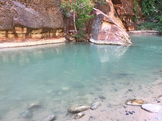 I spent all of Sunday exploring the canyon, riding the shuttle out to Temple of Sinawava and working my way back. The canyon walls were impressively tall, with huge peaks here and there. The Virgin River came through here out of the narrows and many people were swimming and playing in the blue-green water. Here, the dominant rodent was squirrels. They were well accustomed to humans and simply did not give a damn. I saw people almost trip over them on the trail if they weren’t paying attention.
Weeping Rock was pretty interesting. There is a permeable layer of sandstone from which water seeps out of far above and rains down over the trail. There’s all sorts of vegetation growing in the rock and there’s an overhang you can stand under to be shielded from the water and enjoy the view.
It was super hot and I didn’t feel like taking any long hikes. I did hike from the Grotto down to Zion Lodge to take a break, which was about a half mile. At Zion Lodge there was a large lawn with shade trees, many people were laying out on blankets. Around 5 PM the sun went behind the canyon wall, putting the whole area in the shade which was pretty nice.
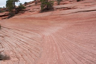
After the canyon, I had dinner at one of the places across the river from the visitors center. Then I started driving through the park taking photographs. One nice place to take photos was the bridge over the Virgin River just beside the junction to the canyon. At sunset the bridge was crowded with people, cameras, and tripods, everyone taking photos of the valley. On the east side of the park the rock formations are quite interesting. There are many fine layers of sandstone and it looks like the rocks were poured out or they were a cloth draped over the ground.
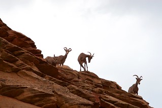 At dusk I saw a bighorn sheep (apparently these are not mountain goats) on the side of the highway. I pulled over to photograph her and discovered a whole herd of about 20 busily eating brush off the side of the road. A few were on top of the rock cliff watching me and the other people that had stopped. There was a buck with impressive horns with them, I never could catch him alone to get a good photo. Eventually the herd had enough and decided to cross the highway, where they were almost ran over several times by cars.
It started to rain after it got dark, so there wasn’t much left to do outside. There were occasional lightning strikes behind Watchman but I wasn’t able to get any photos of them. Instead of truck camping at a trailhead like I did last time, I decided to leave and head down to St George to find a cheap motel. It was so nice to have a shower and a soft bed!
Note to self: next time bring the inflatable Thermarest instead of the foam pad, and buy a full sized camping chair.
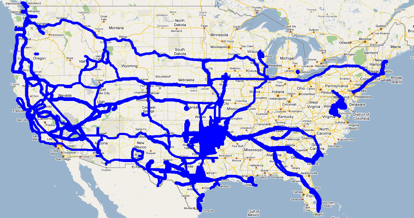
Monday morning I left St George, heading home. I had debated crossing Nevada on hwy 93/375/95 and back through Yosemite so I could fill in my places traveled map but I decided it was too far out of the way and just came back through Las Vegas on the way home.
Milage
7/6
1:52 PM  312,084  Fremont, CA
4:00 PM  312,180  Sacramento, CA
7:30 PM  312,355  Fernley, NV   16.3 gal/271 mi
9:44 PM  312,493  Austin, NV
7/7
1:56 AM  312,656  Ely, NV  17 gal/300 mi
8:00 AM  ?        Great Basin State Park
8:27 AM  ?        Utah state line (Baker, NV)
?        ?        Bryce
?        ?        Zion
7/10
7:15 AM  313,230  St George, UT
8:34 AM  313,328  Garnet, UT
2:13 PM  313,682  I-5 and hwy 46, CA  20.3 gal/353 mi, 8,254.9 hr
5:40 PM  ?        Fremont, CA