Custom aux/roll/null/DCD cable
This is part of the project to connect my Wildcat! BBS to a retro X.25 network, but it also applies more broadly to “reverse telnet” operation of a Cisco router where you telnet/ssh to a router at a given port to access a serial device hanging off of the aux or a terminal line. I don’t think there’s a lot of people seeking this solution, but I’m writing about it for when I eventually forget. This post mainly covers the serial connection and Cisco bits, I’m still clueless about the whole X.25 part.
This isn’t quite as simple as slapping a null modem cable between a serial port on the BBS machine and the aux port on the router, altho that’s part of it and would work. The problem is gracefully disconnecting the reverse telnet/SSH session when the visitor is done so the next person can log in. This is done to improve user experience and increase line availability.
Normally when using a reverse telnet session, it’s expected that a user send a ^] to close the telnet connection or a Ctrl-Shift-6 to break out. Until a the user sends a break/escape or a session-timeout happens, nobody else can use this BBS line. And it’s just not a good experience to tell somebody who’s gone to all the effort to connect to your board to oh yeah do this extra step too please. In the worst case this probably means somebody could tailgate in on the end of last person’s session somehow.
TL;DR:
- Aux cable + modem adapter (with pin 1 and 6 DTR/DCD connected)+ null modem adapter + gender changers
- “line aux 0” set to “modem printer”
- chat script to send a string
- BBS software configured to see said string and start a call, not “auto-answer”
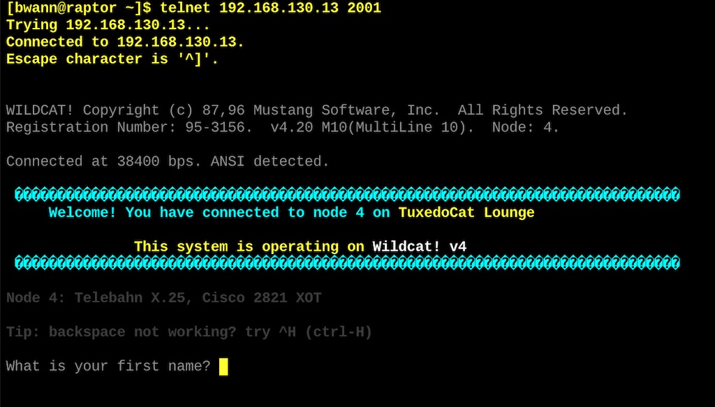
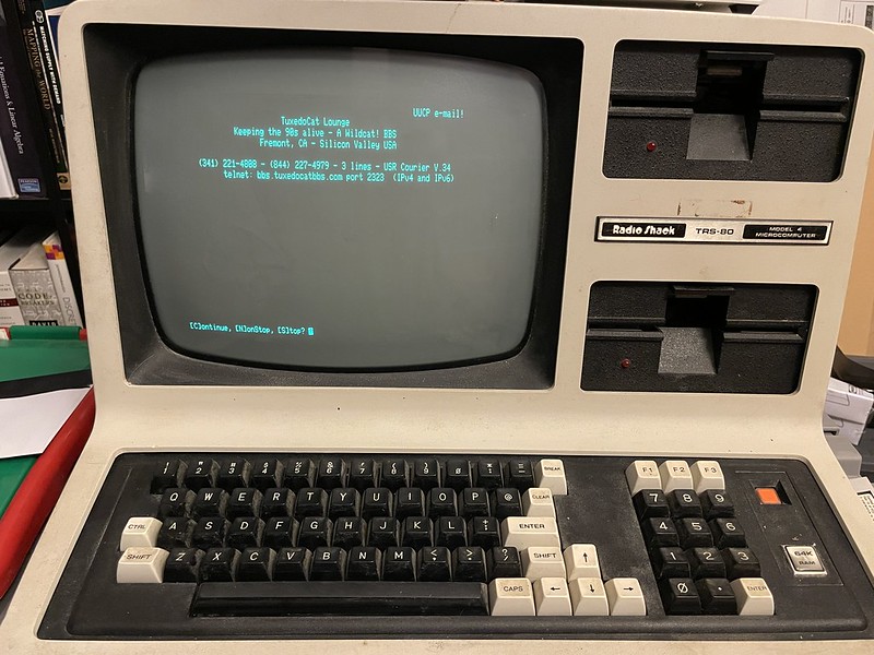
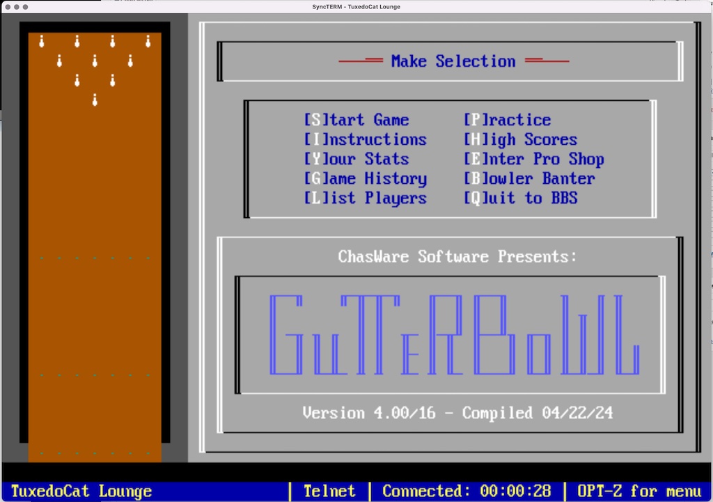
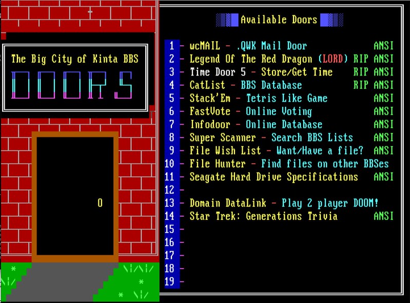
Wildcat! is an MS-DOS program (at least the 4.x version I’m using) that is designed to use RS-232 serial ports to talk to a modem. The manual does discuss connecting to an X.25 PAD, namely a Microtronics CSI-X.25 PAD, so non-modem serial (i.e. using a direct, null modem cable) usage is expected to work.
Wildcat! and probably most BBS software expects to “answer” a serial line and sending a login prompt to the visitor in one of three ways: “auto answer”, detect when the RS-232 CD (carrier detect) line is raised; “ring detect”, detect when RS-232 RI (ring indicate) is raised; and “ring result”, look for specific text strings such as ‘RING’ to indicate an incoming call from a modem. In the latter two cases, Wildcat! will send an “ATA” command to the modem to answer the call. After that, in all cases Wildcat! expects to see a CD signal on the serial port which tells it there’s an active user on the line. If CD is abruptly dropped, Wildcat! will assume the caller has disappeared and will “hang up” its side. If the visitor selects “Goodbye” from the menu screen, Wildcat! will send the DTR (data terminal ready) line low briefly, which is intended to tell the modem to disconnect.
Normally if you connect a PC serial port to a BBS PC serial port with a direct null modem cable, with Wildcat! configured to auto-answer, then start a communications program such as Qmodem, Qmodem will raise DTR as it’s a terminal that’s now ready to process I/O. Wildcat! will see this and immediately send a login prompt to the terminal. However, if somebody logs into the BBS and selects the “Goodbye” menu option to leave, Wildcat! will wrap up the call and get ready for the next caller — in this case with our hardwired connection, in the Qmodem terminal window we’ll immediately see another login prompt. It’s not until Qmodem is exited that Wildcat! finally resets and waits for the next user. (Or you yank the serial cable from the PC).
BBS null modem / X.25 PAD connection
The Wildcat! Sysop Guide really only refers to a one other serial port configuration that doesn’t involve modems, that’s for for hooking up an X.25 PAD. This would allow users to come in via X.25 network such a Telenet or Tymnet, go through the PAD, which acts as a basic terminal server connected to the BBS via multiple serial cables. Which is kind of convenient for me since this is ultimately what I want to do, but with different hardware. If you wanted to configure the BBS to accept connections from something via null modem or a terminal server, you’d have to pick through this section and pull out the bits that look relevant.
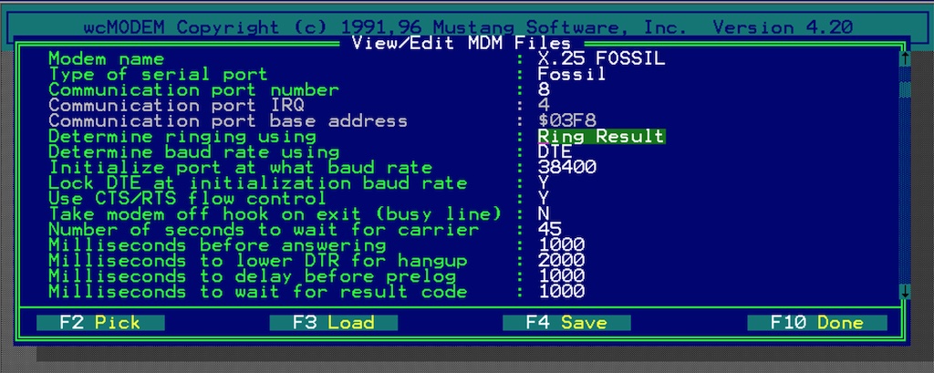
The important part of this section of the manual are the details needed to build a wcMODEM .MDM modem profile file to use for the node that’ll be used for the direct connections. For example, creating a file called like DIRECT.MDM with the specified serial port info, options, and removing the modem commands. Then in the batch file that starts the Wildcat! instance for that node, add in a “WCMDM=DIRECT” to have it load the profile for that node.
I looked up the Microtronix CSI-X.25 PAD mentioned in the manual to get an idea of how it actually handed off serial connections. At the bottom of this post I’ve added some details about the history that I could find, I wasn’t able to find any manuals. Apparently the CSI-X.25 is a box with a number of DB-25 RS-232 ports off the back. It says the PAD is configured to “act like a modem that is in auto answer mode .. simply raises carrier detect (CD) when a call comes in”. It mentions other things here like it supports RTS/CTS hardware flow control, and probably running the serial lines at 9600 or 19200 bps. I’m going to go on a limb and assume it probably supports all serial pins, for example it knows when Wildcat! drops DTR to end the session.
It’s worth mentioning MSI did internally support another terminal server setup. For BBS Direct offered by Concentric, I’m told there was a Xylogics terminal server that received callers via IP/frame relay, and handed off via stack of serial cables to the MSI HQ BBS. I guess they made it all work with their BBS software out of the box.
Cisco operations
You can connect the aux port or an async serial breakout cable from a Cisco router to the serial port of a BBS as well. This could be used to provide inbound telnet/ssh connectivity to a MS-DOS BBS that has no concept of TCP/IP. What I’ve discovered is it’s not great when a user ends their session. It’s the same problem as a PC null modem connection, as soon as the user says “goodbye”, Wildcat! ends their session, and gets ready for the next caller. Except Wildcat! can’t drop the serial connection, you’ll see it eventually sending ++++ ATH0 AT&C1D1 commands desperately trying to get rid of the caller and blindly initializing a modem. Then another login prompt is sent.
As mentioned, until a the user sends a break/escape or a session-timeout happens, nobody else can use this BBS line.
What needs to happen is two things: 1) When the session first starts, the Cisco needs to raise DTR to activate the line and raise CD so Wildcat! knows there’s a visitor there. 2) when a visitor says “goodbye” to the BBS, the Cisco needs to see DTR being temporarily lowered by Wildcat! as a signal to boot the reverse telnet session.
Cabling
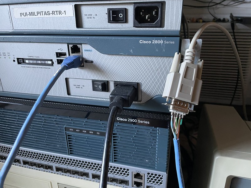
This setup only works on the aux port or terminal lines via WIC or NM card. To make any of this work start with the serial cable being used. Cisco used to ship along with their baby blue console cables two adapters, a RJ-45/8P8C to DB-9 “terminal” adapter for connecting a PC to the console port for initial configuration, and a RJ-45/8P8C to DB-25 “modem” adapter for connecting a modem to the console or aux port. The difference between the two is the “terminal” adapter took care of setting up a null modem connection (i.e. crossing RX/TX) for you, however the DCD and RI pins are completely left unconnected as they’re not needed. The “modem” adapter is straight through, but connects DCD to DTR, but only comes in DB-25 form.
Apologies: As an aside it’s maddening following pins that get rolled from the aux port to the Cisco blue roll (not Ethernet crossover) cable to the various adapters. It gets confusing to me which signal to talk about too, since they’re all ultimately wired together — do I say pin 6, or do I say DSR or DTR? So if I say DSR and probably mean DTR signal, forgive me.
You’ll either need to use the DB-25 modem adapter in addition to a null modem adapter, and probably a gender changer too somewhere, or edit the DB-9 terminal adapter to add a DCD pin. This turns into quite a stack of connectors. For this experiment my BBS only has DB-9 serial ports coming out the back, so I wound up making my own combo roll + DB-9 + null modem + add DCD cable. I imagine with the newer Cisco console cables that have a molded DB-9 adapter attached, you’ll need a null and a way to fix DCD.
Remember, Wildcat! expects DCD to be up so we have to have that pin connected to something. Only using RI won’t work either, while that may signal that there’s a new connection, Wildcat! still requires DCD afterwards.
It remains to be seen what kind of adapters are needed to do this for something like a CAB-OCTAL-ASYNC from a NM-16A.
Believe it or not, all of these cable combos below do the same thing. Mine is much simpler and prettier but I don’t want to solder more connectors like it.
My ultimate awesome Aux RJ-45 + roll + null + DTR/CD DB-9 cable
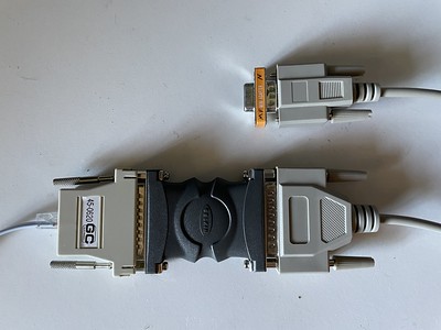
A roll cable, DB-25 adapter, gender changer, DB 9/25, cable and a null oh my
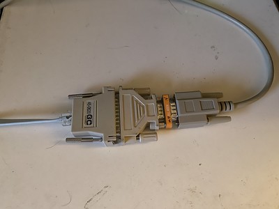
Another abomination
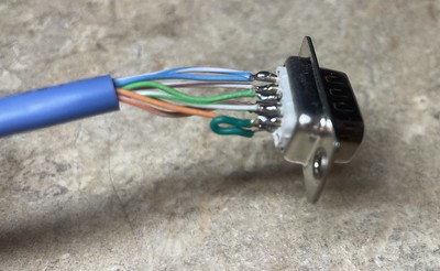
My awesome cable pinout, using a regular RJ-45 Ethernet cable, chop off one end and connect as follows (ignore all the labels and just pay attention to the pin numbers):
RJ-45  (Aux)   -  DB-9
1 w/o  (RTS)   -  pin 8 (CTS)
2 o    (DTR)   -  pin 6 (DSR, pin 6 also jumpered to pin 1)
3 g/w  (TXD)   -  pin 2 (RXD)
4 bl   (GND)   -  pin 5 (GND)
5 bl/w (GND)   -  pin 5 (GND, blues are grounds, connect together)
6 g    (RXD)   -  pin 3 (TXD)
7 br/w (DSR)   -  pin 4 (DTR)
8 br   (CTS)   -  pin 7 (RTS)
-n/a-          -  pin 1 (jumpered to pin 6)
Plug directly into aux port of router.
Aux port configuration
TL;DR: Through much trial and error I settled on configuring my aux port as “modem printer” and “script connection RINGRING” which I’ll explain why.
Cisco IOS provides a variety of options for setting up the aux port for serial operations, and there’s a whole document describing modem signal and line states. Here’s a document for aux pinouts too.
vintage-gw2(config)#line aux 0
vintage-gw2(config-line)#modem ?
  CTS-Alarm       Alarm device which only uses CTS for call control
  DTR-active      Leave DTR low unless line has an active incoming connection or EXEC
  Dialin          Configure line for a modern dial-in modem
  Host            Devices that expect an incoming modem call
  InOut           Configure line for incoming AND outgoing use of modem
  Printer         Devices that require DSR/CD active
  always-on       Configure line for a modern always-on modem
  answer-timeout  Set interval between raising DTR and CTS response
  autoconfigure   Automatically configure modem on line
  dtr-delay       Set interval during which DTR is held low
  onhold          Set the V.92 modem on hold timer duration

vintage-gw2(config-line)#
Ideally we need a config option that does /something/ different on the serial line when a reverse telnet session is started, that way we have signal (a literal electrical signal) to the BBS that there’s a new visitor on the line. Then we could wire that up to DCD so that pin is alive when there’s a reverse telnet session in progress. Also we do not care at all about “inbound” or “exec” sessions, that’s for something connecting TO the Cisco from a serial port.
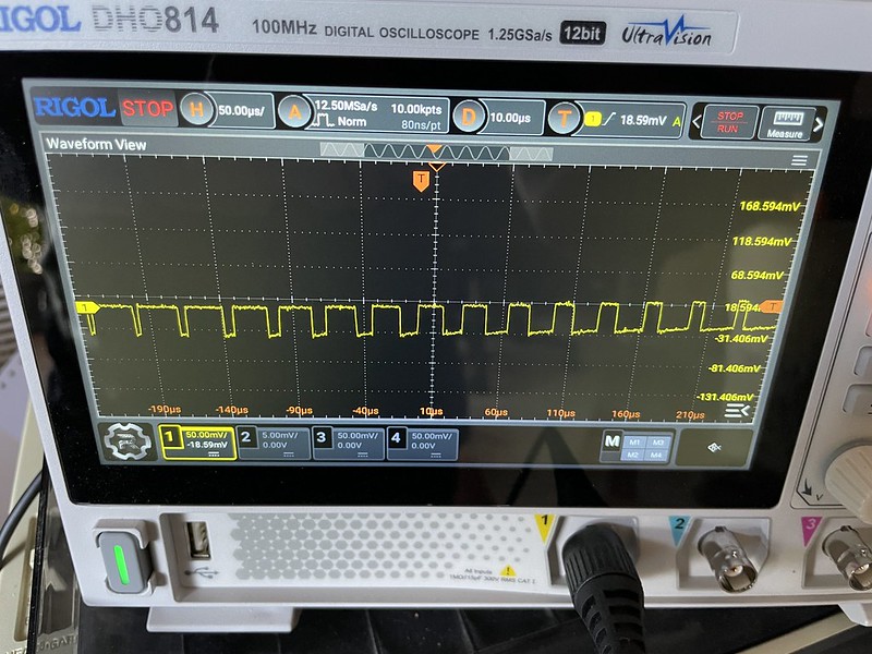
I’ve gone through every single one of these options with an RS-232 LED breakout and there are exactly two options, “modem Host” and “modem DTR-active” that actually change state. They raise/lower pin 6 for DTR. Normally it’s low/off, but when a remote telnet session comes in, DTR is raised. All other pins 4, 7, 8 all stay the same. One would assume they could connect pin 6 to pin1 so that when DTR is raised it also raises DCD, and Wildcat! could be set up to auto-answer. While that is technically true and does get the visitor to the BBS, it doesn’t solve our original problem of graceful session endings.
I did find other people sell Cisco DB-9 connectors with DSR/DTR connected to DCD (pin 1 and 6), so I’m not crazy in imagining this need.
Nice, but this isn’t the problem we’re trying to solve!
Bye bye bye
Now we need a way to signal back from the BBS to the Cisco that the session is ended, the serial line has been dropped, go disconnect the reverse telnet session.
When a person does “goodbye” from Wildcat!, Wildcat! lowers DTR from the BBS side. When connected to a null modem adapter, this means DSR on the Cisco side changes — except when using “modem Host” or “modem DTR-active” nothing is paying attention to DSR! The Cisco has no idea Wildcat! is telling it the user has hung up and keeps DTR high.
The only option I found is “modem Printer“. Apparently there used to be an option called “modem cts-active” that got replaced by “modem Printer“, but “modem Printer” isn’t really documented in the Modem Signal and Line States document. Anyways IOS says “modem printer” is “Devices that require DSR/CD active“. That’s exactly what we want here, when Wildcat! lowers DTR, it lowers DSR on the Cisco side and yeets the reverse telnet session!
But, this conflicts with our previous step in that with “modem printer” our DTR and thus CD is always asserted! Wildcat! will not be able to auto-answer and we’ll never get a new caller!
RINGRING banana phone
With “modem printer” configured on the aux port to gracefully disconnect visitors, and our DCD line is hardwired to be constantly active, we need another way to signal to Wildcat! that there’s an inbound caller.
What I did here was configure Wildcat! to use “ring result” and gave it a completely made up string to look for, “RINGRING“.
wcMODEM .MDM file for my fake X.25 PAD
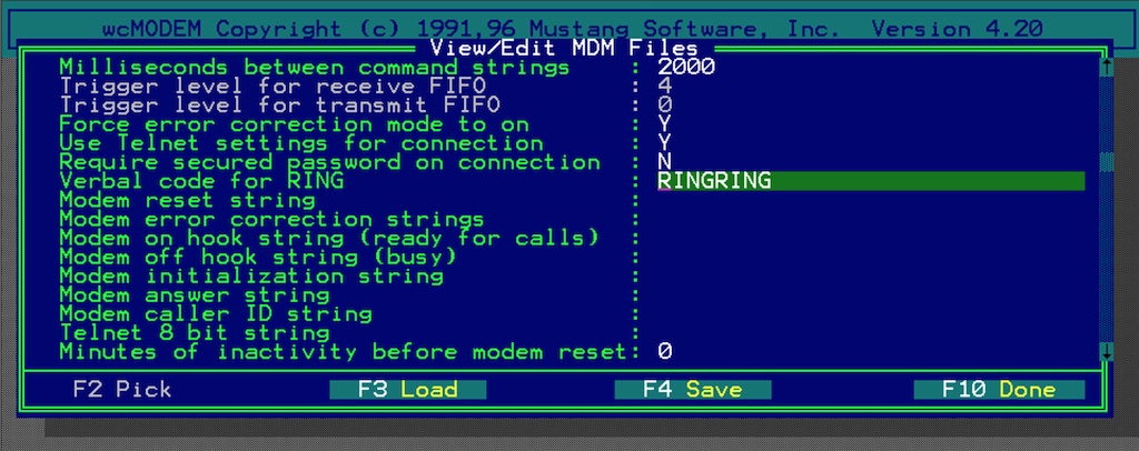
Made up RINGRING string
Then on the Cisco side, I configured a simple “chat-script RINGRING "" RINGRING“, and on the aux port, “script connection RINGRING“.
Now when a reverse telnet session starts up, the Cisco sends the text “RINGRING” down the serial port. Wildcat! sees this and answers the line, all transparent to the user. The visitor can use the BBS all they want, I even tested this downloading a 10 MB file with Ymodem and it all worked.
Along with the right cable and aux settings, then when the user says goodbye from the BBS, their reverse telnet session gets gracefully disconnected.
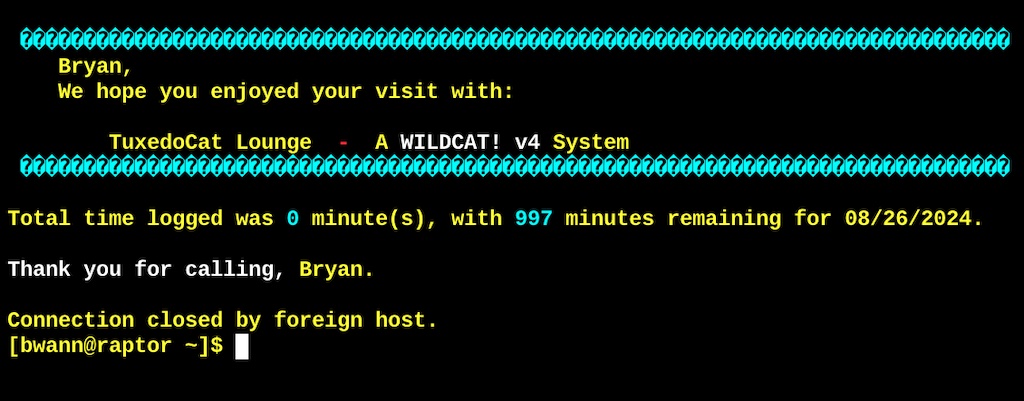
For whatever reason this is not completely perfect, both the Cisco and Wildcat! seem to be trying to fiddle with serial lines for several seconds before things settle down and the next visitor can log in. But it’s a heck of a lot better than what it was!
Final Cisco config:
!
chat-script RINGRING "" RINGRING
!
line aux 0
 session-timeout 5
 no motd-banner
 script connection RINGRING
 modem answer-timeout 5
 modem Printer
 rotary 1
 no exec
 transport input pad telnet ssh
 autohangup
 stopbits 1
 speed 38400
 flowcontrol hardware
!
It also has the nice benefit that if the BBS is down or if a visitor is already using the BBS, the Cisco sends a “Connection refused” instead of black-holing the caller into nothingness of an empty session. I tried setting up some sort of “connection in use, try again later” thing, but doesn’t work like this.
For whatever reason I have the .MDM file set up to force “yes this is a reliable connection give me Ymodem/G” option, but it doesn’t take effect. I tried configuring the Cisco to send something like “FAKELAPM” as a string to tell Wildcat! it supported error correction and enable it, or send “VMP” to pretend it’s an OS/2 virtual modem, but neither worked. Oh well.
This is what the aux port looks while idle:
vintage-gw2#show line aux 0
   Tty Line Typ     Tx/Rx    A Modem  Roty AccO AccI  Uses  Noise Overruns  Int
      1    1 AUX  38400/38400 - printer   1    -    -   142     34 1786/5780   -

Line 1, Location: "", Type: ""
Length: 24 lines, Width: 80 columns
Baud rate (TX/RX) is 38400/38400, no parity, 1 stopbits, 8 databits
Status: Ready, No Exit Banner, CTS Raised, Modem Signals Polled
Capabilities: EXEC Suppressed, Hardware Flowcontrol In,
  Hardware Flowcontrol Out, Modem CTS-Required, Hangup on Last Close
  MOTD Banner Suppressed
Modem state: Ready
Modem hardware state: CTS* DSR*  DTR RTS
Rotary address 51010000
Special Chars: Escape  Hold  Stop  Start  Disconnect  Activation
                ^^x    none   -     -       none
Timeouts:      Idle EXEC    Idle Session   Modem Answer  Session   Dispatch
               00:10:00       00:05:00                       none     not set
                            Idle Session Disconnect Warning
                              never
                            Login-sequence User Response
                             00:00:30
                            Autoselect Initial Wait
                              not set
Modem type is unknown.
Session limit is not set.
Time since activation: never
Editing is enabled.
History is enabled, history size is 20.
DNS resolution in show commands is enabled
Full user help is disabled
Allowed input transports are pad telnet ssh.
Allowed output transports are pad telnet rlogin lapb-ta mop v120 ssh.
Preferred transport is telnet.
Shell: enabled
Shell trace: off
No output characters are padded
No special data dispatching characters
And this is what it looks like with a user on (not much difference):
vintage-gw2#show line aux 0
   Tty Line Typ     Tx/Rx    A Modem  Roty AccO AccI  Uses  Noise Overruns  Int
*     1    1 AUX  38400/38400 - printer   1    -    -   143     34 1786/5780   -

Line 1, Location: "", Type: "SCREEN"
Length: 59 lines, Width: 174 columns
Baud rate (TX/RX) is 38400/38400, no parity, 1 stopbits, 8 databits
Status: Ready, Connected, Active, No Exit Banner, CTS Raised
  Modem Signals Polled
Capabilities: EXEC Suppressed, Hardware Flowcontrol In,
  Hardware Flowcontrol Out, Modem CTS-Required, Hangup on Last Close
  MOTD Banner Suppressed
Modem state: Ready
Modem hardware state: CTS* DSR*  DTR RTS
Rotary address 51010000
Special Chars: Escape  Hold  Stop  Start  Disconnect  Activation
                ^^x    none   -     -       none
Timeouts:      Idle EXEC    Idle Session   Modem Answer  Session   Dispatch
               00:10:00       00:05:00                       none     not set
                            Idle Session Disconnect Warning
                              never
                            Login-sequence User Response
                             00:00:30
                            Autoselect Initial Wait
                              not set
Microtronix CSI-X.25 PAD
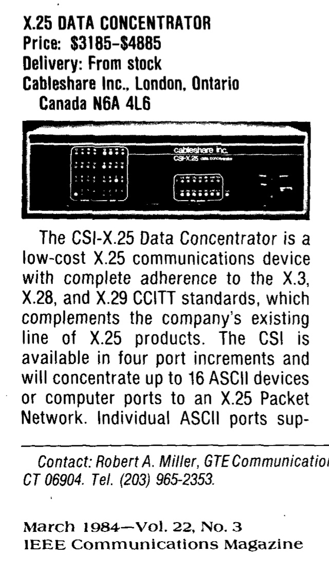
Cableshare Inc X.25 Data Concentrator
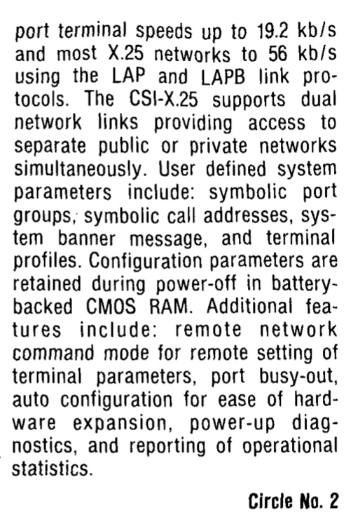
The PAD that’s mentioned in the Wildcat! has definitely been lost to time. I can find very little about this, no manuals, and maybe a couple of times it was for sale 30 years ago. Doing some sleuthing apparently it was originally made by Cableshare Inc. in London, Ontario as the “X.25 Data Concentrator”, and then starts showing up as the Microtronix CSI-X.25, who is also based in London, Ontario. I’m assuming CSI == Cableshare Inc. I found exactly two articles even talking about it, an IEEE Communications Magazine “New Products” article from March 1984 that has the only photo of it, and a Computerworld from December 12, 1983 announcing it at $2,700 per port for a four port config. Sounds like off the back it had up to 16 DB-25 ports for connecting to thing.
So if you see one or its manuals, send it my way! Microtronix is still around, looks like they did a couple more X.25 devices, but have long left it behind.
Tags: bbs, cisco
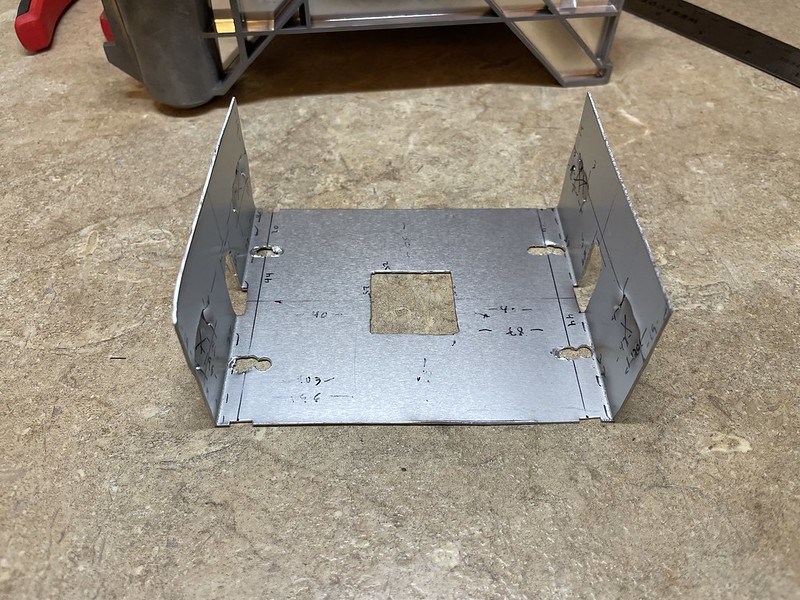
 Being punched through actually worked pretty well at giving me protruding tabs on the outside surface, smoothing a bit here and there with pliers to get it just right. Next up I used my metal brake to fold the sides up. I didn’t trim the tops of the vertical pieces like the original to provide finger tabs, it seemed to fit fine without them.
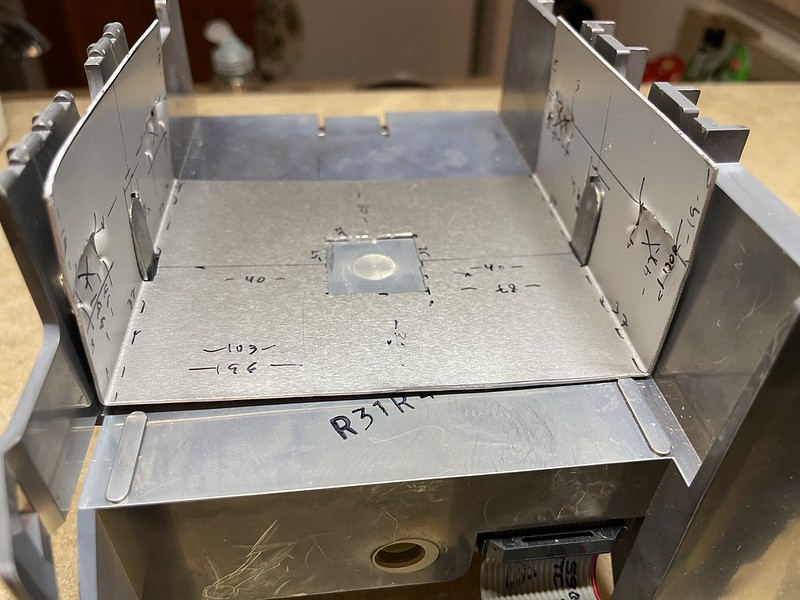


