
I’ve been late to the game of nerding out on the telephone network and phreaking in general and it’s been fun browsing over old maps. I was browsing the “Central section” microwave map on the AT&T Long Lines Places and Routes website and was surprised to see my home town, Kinta, on the map. I grew up with a tall microwave tower on top of what we know as Beaver Mountain a few miles north of Kinta. I sort of knew it was owned by AT&T (now SBC, now at&t), but I had no idea until now it was part of the fabled AT&T Long Lines division. I also frequently passed the tower at Krebs on the way to McAlester, as it was just off highway 31. From looking at the larger map, it appears both were part of a microwave relay link between St Louis, MO and Fort Worth, TX.
The microwave horns and what not were stripped some time ago on the tower on Beaver Mountain, it’s just sort of standing there now. The tower at Krebs was also stripped of it’s microwave kit and was replaced by various random antenna.
The Internet seems pretty sparse with information about either of these two towers, I’m curious to know if there’s more about them anywhere. The map I found was dated October 1966, so presumably they were in service then, but I have no idea when they were decommissioned. They’d make awesome observation decks!
Edit (Feb 2018): According to FCC Antenna Structure Registration (#1010196), the tower now belongs to “Communication Enhancement”, as site #20031. It stands at 263′ tall.

Update 4/2026: I snapped this new photo while I was in town. It looks like there may finally be something new on top of the tower, I couldn’t quite tell. It may be a new beacon, or something like a Ubiquiti AirFiber dish or some sort of fixed PTP microwave setup.
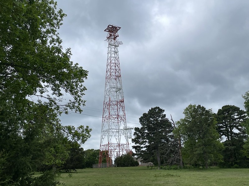
2026 Long Lines tower